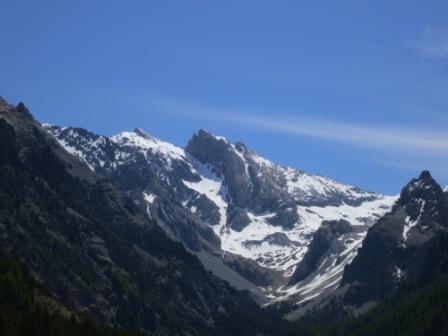
Font Sancte's peak from Basse Rua
Level of difficulty: Difficult
Elevation gain: 1700 m
Distance: 16 km
Duration:
10h00
"The Font Sancte, the highest peak in the Queyras Regional Nature Park, takes its name from a very ancient legend which says that a shepherdess from Escreins (hamlet destroyed by fire in 1916) discovered, while following her white goat, a beautiful spring of clear water emerging from a circular hole in the rock which looked as if it had been made by a cannonball. So the spring was named ‘Font Sainte' (holy font). The Font Sancte summit is the highest point of a mountain chain that reaches elevations exceeding 3,000 metres, from Pointe de la Saume (3,406m) in the east to Pic des Houerts (3,236 metres) to the west.
This hike demands an excellent level of physical fitness.
There is often snow in the couloir leading to the summit so crampons and ice axes may be required. Even when the snow has gone, falling rocks are a hazard to be wary of.
Whatever the conditions, you should set out at daybreak. "
This hike demands an excellent level of physical fitness.
There is often snow in the couloir leading to the summit so crampons and ice axes may be required. Even when the snow has gone, falling rocks are a hazard to be wary of.
Whatever the conditions, you should set out at daybreak. "
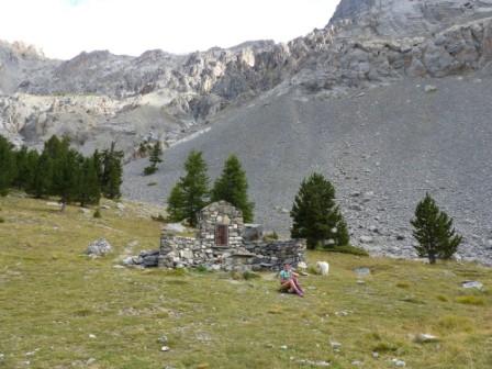
This itinerary can be reached from the following accommodations:
on the map
Click on the green boxes below to reserve this refuge :
Caption:
 beds available
refuge full
refuge closed
beds available
refuge full
refuge closed
beds available
refuge full
refuge closed
on the map
To find out if there is room at the refuge, please contact the guardian by phone
Tel. (During the season): 04 92 45 32 44
on the map
Click on the green boxes below to reserve this refuge :
Caption:
beds available
refuge full
refuge closed
beds available
refuge full
refuge closed
on the map
Click on the green boxes below to reserve this refuge :
Caption:
beds available
refuge full
refuge closed
beds available
refuge full
refuge closed
on the map
Click on the green boxes below to reserve this refuge :
Caption:
beds available
refuge full
refuge closed
beds available
refuge full
refuge closed


Creation: Alliance-Réseaux